| Gamron [Bandar Abbas], een groot vlek in het Lantschap Kirman, nite verre van Ormus [Gamron, a large village in the Kerman district, not far from Hormuz] by Pieter Schenk published in Amsterdam (MCA/01/02/06/03) | ||
| Publication Date: |
[1702] | |
| Creator: |
Schenk, Peter, 1660-1718 or 1719 | |
| Material: |
Paper | |
| Technique: |
Hand coloured | |
| Subjects: |
Maps -- Early works to 1800 ایران -- آسیا نقشه ها -- کارهای اولیه، تا 1800 | |
| Source Institution: |
SOAS, University of London | |
| Donor: |
Dr. Cyrus Ala'i | |

| Perse [Persia] by mapmakers Juan Leonard and Sebastian de Medrano and published in Brussels (MCA/01/01/03/13) | ||
| Publication Date: |
[1690] | |
| Creator: |
Leonard, Juan Fernández de Medrano, Sebastián, 1646-1705 | |
| Material: |
Paper | |
| Measurements: |
map 13x15cm mounted on board | |
| Technique: |
Hand coloured | |
| Subjects: |
Maps -- Early works to 1800 ایران -- آسیا نقشه ها -- کارهای اولیه، تا 1800 | |
| Source Institution: |
SOAS, University of London | |
| Donor: |
Dr. Cyrus Ala'i | |

| Carte de Perse dresse pour l'usage du Roy [Map of Persia drawn up for the use of the King] by Guillaume Delisle engraved by J Stemmers and P Starkman and published in Paris (MCA/01/01/04/08) | ||
| Publication Date: |
1724 | |
| Creator: |
L'Isle, Guillaume de, 1675-1726 Strackman, P. Stemmers, J. | |
| Material: |
Paper | |
| Measurements: |
map 49x62 on sheet 51.5x64cm | |
| Technique: |
Hand coloured | |
| Subjects: |
Maps -- Early works to 1800 ایران -- آسیا نقشه ها -- کارهای اولیه، تا 1800 | |
| Source Institution: |
SOAS, University of London | |
| Donor: |
Dr. Cyrus Ala'i | |

| Persia and Afghanistan published by Rand McNally & Co. in Chicago (MCA/01/01/07/07) | ||
| Publication Date: |
1895, 1902 | |
| Publisher: |
Rand McNally & Co | |
| Material: |
Paper | |
| Measurements: |
map 23.5x32 on sheet 28x35.5cm | |
| Technique: |
Coloured | |
| Subjects: |
ایران -- آسیا Asia -- Afghanistan Asia -- Pakistan -- Balochistan اسیا -- افغانستان اسیا -- پاکستان -- بلوچستان ਏਸ਼ੀਆ - ਅਫਗਾਨਿਸਤਾਨ ਏਸ਼ੀਆ - ਪਾਕਿਸਤਾਨ - ਬਲੋਚਿਸਤਾਨ | |
| Source Institution: |
SOAS, University of London | |
| Donor: |
Dr Cyrus Ala'i | |
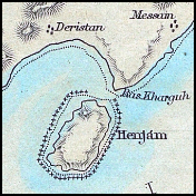
| Map of the Island of Kishm (Qeshm) to accompany the paper by Lieut Col Lewis Pelly published in London for the Journal of the Royal Geographical Society by John Murray (MCA/01/02/04/07) | ||
| Publication Date: |
[1864] | |
| Publisher: |
John Murray | |
| Material: |
Paper | |
| Measurements: |
map 11x18 on sheet 14x22cm | |
| Technique: |
Coloured | |
| Subjects: |
ایران -- آسیا | |
| Source Institution: |
SOAS, University of London | |
| Donor: |
Dr. Cyrus Ala'i | |

| Rough plan of L.M.S. property in Bhowanipore, South Calcutta | ||
| Publication Date: |
1928 | |
| Creator: |
[London Missionary Society] | |
| Publisher: |
manuscript ( Bhowanipore, India ) | |
| Format: |
1 map ; 34 x 41 cm | |
| Subjects: |
London Missionary Society Bhowanipore (India) এশিয়া - ভারত - পশ্চিমবঙ্গ - রাষ্ট্রপতি বিভাগ - কলকাতা জেলা - কলকাতা - ভবানীপুর एशिया - भारत - पश्चिम बंगाल - प्रेसीडेंसी डिवीजन - कोलकाता जिला - कोलकाता - भवानीपोर | |
| Source Institution: |
SOAS University of London | |

| The Kingdom of Persia engraved by J Hatchett published in London by William Faden (MCA/01/01/06/17) | ||
| Publication Date: |
[1798] | |
| Publisher: |
William Faden | |
| Material: |
Paper | |
| Measurements: |
map 12x10 on sheet 17.5x15.5cm | |
| Technique: |
Hand coloured | |
| Subjects: |
Maps -- Early works to 1800 ایران -- آسیا نقشه ها -- کارهای اولیه، تا 1800 | |
| Source Institution: |
SOAS, University of London | |
| Donor: |
Dr. Cyrus Ala'i | |

| Persia, Afghanistan and Beloochistan [Balochistan] by J. Bartholomew published in London and Glasgow by William Collins Sons & Co (MCA/01/01/06/69) | ||
| Publication Date: |
1870 | |
| Creator: |
Bartholomew, J.G. (John George), 1860-1920 | |
| Publisher: |
William Collins Sons & Co | |
| Material: |
Paper | |
| Measurements: |
map 32.5x42.5 on sheet 37x47cm | |
| Technique: |
Coloured | |
| Subjects: |
ایران -- آسیا | |
| Source Institution: |
SOAS, University of London | |
| Donor: |
Dr. Cyrus Ala'i | |

| Turquie d'Asie et Perse [Asiatic Turkey and Persia] engraved by I Smith with lettering by A Bizet and published in Paris by Charles Lacoste (MCA/01/01/04/19) | ||
| Publication Date: |
1874 | |
| Publisher: |
Charles Lacoste | |
| Material: |
Paper | |
| Measurements: |
map 32x42 on sheet 39x52cm | |
| Technique: |
Hand coloured | |
| Subjects: |
ایران -- آسیا | |
| Source Institution: |
SOAS, University of London | |
| Donor: |
Dr. Cyrus Ala'i | |

| Red Sea published in Edinburgh by W & AK Johnston (MCA/01/01/06/74) | ||
| Publication Date: |
[1892] | |
| Publisher: |
W and AK Johnston | |
| Format: |
1 map | |
| Material: |
Paper | |
| Technique: |
Engraving | |
| Source Institution: |
SOAS, Univerity of London | |
| Donor: |
Dr. Cyrus Ala'i | |

| De l'Asie Figure LXXIII Ispahan (Isfahan) with text titled Du Meydan, & du palais des Roys de Perse on the back [by Allain Mallet published in Paris by Denys Thierry] (MCA/01/02/06/06) | ||
| Publication Date: |
[1683] | |
| Publisher: |
Denys Thierry | |
| Material: |
Paper | |
| Measurements: |
image 14x9.5 on sheet 21x14cm | |
| Technique: |
Black and white | |
| Subjects: |
Maps -- Early works to 1800 ایران -- آسیا نقشه ها -- کارهای اولیه، تا 1800 | |
| Source Institution: |
SOAS, University of London | |
| Donor: |
Dr. Cyrus Ala'i | |

| Part of the Jerahi River with its canals by Austin Henry Layard, cartography by John Arrowsmith published in London by John Murray for the Royal Geographical Society (MCA/01/02/08/02) | ||
| Publication Date: |
[1846] | |
| Publisher: |
John Murray for the Royal Geographical Society | |
| Material: |
Paper | |
| Measurements: |
map 20.5x12 on sheet 22x28cm | |
| Technique: |
Black and white | |
| Subjects: |
ایران -- آسیا | |
| Source Institution: |
SOAS, University of London | |
| Donor: |
Dr. Cyrus Ala'i | |

| Perse moderne [Modern Persia] by mapmaker Alain Manesson Mallet published in Paris by Denys Thierry with a text titled De la ville d'Hisfahan [Isfahan] capitale de la Perse on the back (MCA/01/01/04/04) | ||
| Publication Date: |
[1683] | |
| Publisher: |
Denys Thierry | |
| Material: |
Paper | |
| Measurements: |
map 14x10 on sheet 21x14cm | |
| Technique: |
Black and white | |
| Subjects: |
Maps -- Early works to 1800 ایران -- آسیا نقشه ها -- کارهای اولیه، تا 1800 | |
| Source Institution: |
SOAS, University of London | |
| Donor: |
Dr. Cyrus Ala'i | |

| A Plain chart of the Caspian Sea, According to the Observations of Capt John Elton, Author of Elton's Quadrant & Thomas Woodroofe Master of the British ships Empress of Russia who Navigated this Sea three years, Presented to Mr Jonas Hanway of St Petersburg in 1745 by his most Obedient Servant Thomas Woodroofe (MCA/01/02/03/07) | ||
| Publication Date: |
1753 | |
| Creator: |
Elton, John Woodroofe, Thomas | |
| Material: |
Paper | |
| Measurements: |
map 34x24 on sheet 38x56.5cm | |
| Technique: |
Black and white | |
| Subjects: |
Maps -- Early works to 1800 ایران -- آسیا نقشه ها -- کارهای اولیه، تا 1800 Caspian Sea -- 1753 دریای خزر -- 1753 | |
| Source Institution: |
SOAS, University of London | |
| Donor: |
Dr. Cyrus Ala'i | |

| Modern Jerusalem - Ancient Jerusalem | ||
| Publication Date: |
[1800-1900] | |
| Measurements: |
25 x 33 cm | |
| Subjects: |
آسيا -- فلسطين Asia -- Palestine -- Jerusalem Governate -- Jerusalem آسيا -- فلسطين --- محافظة القدس -- القدس آسيا -- إسرائيل -- القدس -- القدس אסיה -- ישראל -- ירושלים -- ירושלים אסיה -- פלסטין -- ירושלים נפה -- ירושלים | |
| Source Institution: |
SOAS, University of London | |
 The Dr Cyrus Ala’i’s Map Collection of Persia